Report from
the edge
At the rim
of the urban cores
in metropolitan
contexts
AREA DI INDAGINE
Rotterdam, Torino, (Madrid), (Milano)
FOTO
Alessandro Guida
TESTI - RICERCA
Viviana Rubbo
ANNO
2017 - XXXX
I contenuti di questa pagina sono il nostro contributo ad un progetto realizzato come collettivo Urban Reports
IT
Sviluppato in 4 diverse città europee (Rotterdam, Madrid, Torino e Milano), il progetto “Report from the edge of the city” ha esplorato una metodologia per sviluppare nuovi elementi di conoscenza relativi allo sviluppo urbano contemporaneo partendo dall'esplorazione dei limiti geografici di queste città realizzando un'analisi comparativa tra questi esempi.
Il progetto propone la fotografia documentaria come strumento di lettura dell'identità territoriale presente e testimonianza visiva di come le abitudini di vita, l’uso e l'economia di un territorio, possano dare origine e forma agli spazi di margine. In questa prospettiva, la lettura fotografica diventa materiale di indagine per produrre conoscenza e nuove idee che possono essere integrate nei processi di pianificazione e policy-making delle città indagate, anche attraverso la creazione di collaborazioni con diversi soggetti, tra cui esperti e professionisti di diverse discipline, centri di ricerca e istituzioni culturali. In questo contesto, il collettivo Urban Reports si propone come piattaforma interdisciplinare per lo sviluppo, la raccolta e la condivisione delle conoscenze prodotte.
Con questo progetto si sono voluti esplorare i confini della città adottando la fotografia come strumento per comprenderne l'identità in una fase di profonda trasformazione. Il progetto è un catalogo di paesaggi, esplorati lungo un quadro tematico a tre assi:
> forme urbane,
> infrastrutture,
> aree di transizione.
Ogni città rappresenta un episodio, un tentativo di definire una nuova narrativa territoriale per queste città associate a tutt’altro immaginario, esplorandone gli spazi dall’identità incerta e fluida, dove persone e beni, servizi, economia e governo del territorio riguardano sistemi extra-comunali.
Territori la cui rappresentazione è ancora inesistente.
EN
Developed in 4 different European cities (Rotterdam, Madrid, Turin and Milan), the project “Report from the edge of the city” wants to explore a methodology to master the urban change starting from the exploration of the geographic limits of those cities and make a comparative analysis among those examples.
The project proposes documentary photography as a reading tool for contemporary territorial identity and a visual evidence of how the habits, the use of a territory and its economy may affect and shape those spaces at the margins. In this perspective, the photographic analysis becomes the study material for producing knowledge and new ideas that can be integrated into the processes of planning and policymaking, also through the establishment of long-term partnerships with experts and professionals from different disciplines as well as urban centers and partner institutions in those four cities. In this context, the collective Urban Reports presents itself as the platform for developing, gathering, and sharing the knowledge produced.
With this project, we would like to explore the edge of the city adopting photography as a tool to understand the identity of territories undergoing radical changes. The project is a catalogue of landscapes, explored along a three-axis thematic framework:
> urban forms,
> infrastructures
> transitional areas.
Each city represents an episode, an attempt to make a different narrative of those well-known cities and explore those spaces of misty identity in a liquid territory, where people and goods, services, economy, and territorial governance go far beyond the municipal limits.
Territories whose representation is still missing.
'Come dare una rappresentazione a questa realtà?'
Con l'ambizione di documentare e comprendere meglio quali sono le forme e le morfologie dei confini comunali oggi, il progetto introduce un ulteriore strumento di analisi e riflessione, proponendo un metodo sperimentale di osservazione della mutazione e della continua evoluzione dei paesaggi urbani.
Come sono oggi i confini di queste città? Come si stanno trasformando? Si tratta di territori al centro delle visioni strategiche alla scala metropolitana con una prospettiva a lungo termine ( 2040 – 2050). Sono il futuro. Si tratta di capire quale sarà la città di domani nel suo insieme e come cambieranno negli anni a venire i modelli urbani, in particolare quelli ai margini.
Ed è da qui che parte la nostra esplorazione.
‘How do we give a representation to this reality?’
With the ambition to document and better understand what are the forms and morphologies of the city borders today, the project introduces a supplementary tool of analysis and reflection, proposing itself as an experimental means of observation of the mutation and endless evolution of urban landscapes.
How those city’s borders look like? How are they currently being transformed? They are the territories at the center of metropolitan strategic visions and long-term transformation plans dating 2040-2050. They are the future. It’s about understanding what the city of tomorrow will be as a whole and how the urban patterns at the margins, will change in the years to come.
And this is where we wanted to start our exploration.
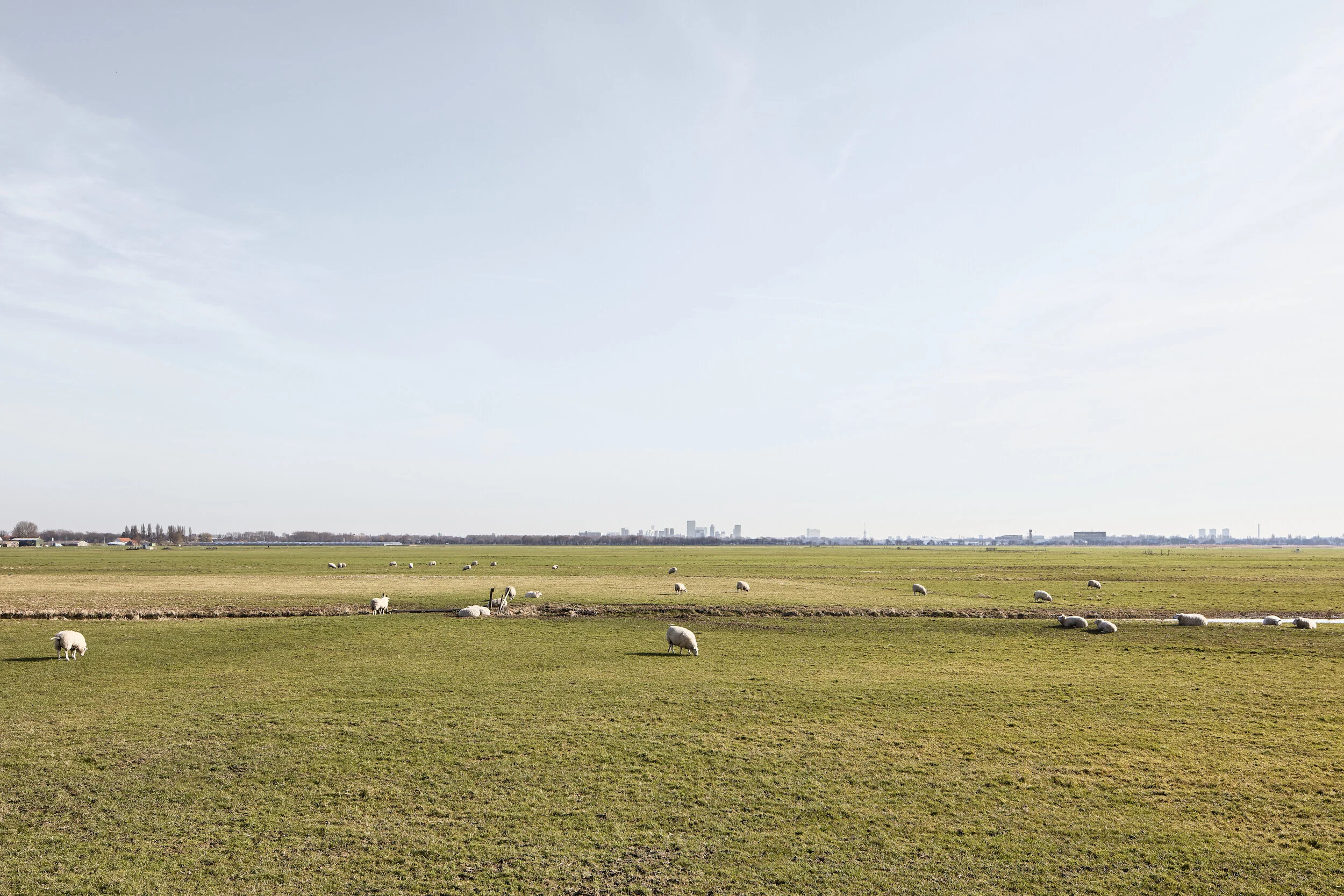
Land parcels in Nesselande, Rotterdam, 2017
The administrative borders of most European cities are outdated. Urbanization has happened unevenly, driven by different forces at different times and in different cities. As a result, the urban fabric has developed beyond the formal borders of most cities.’
(Metropolitan cities in action, Eurocities, MAIA Study, November 2013)
Rotterdam
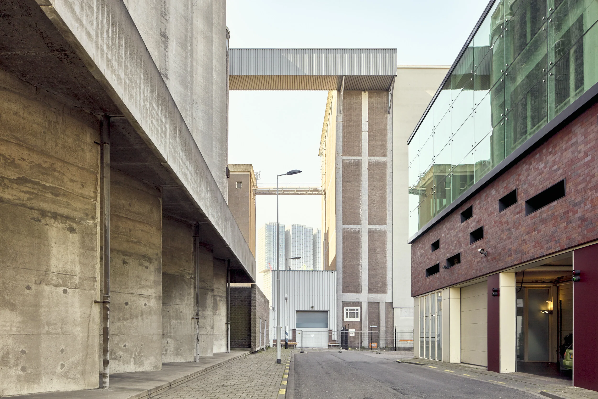
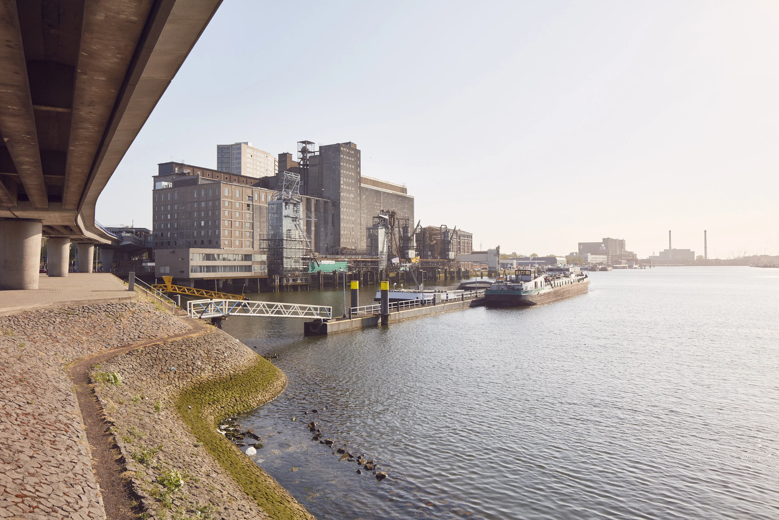
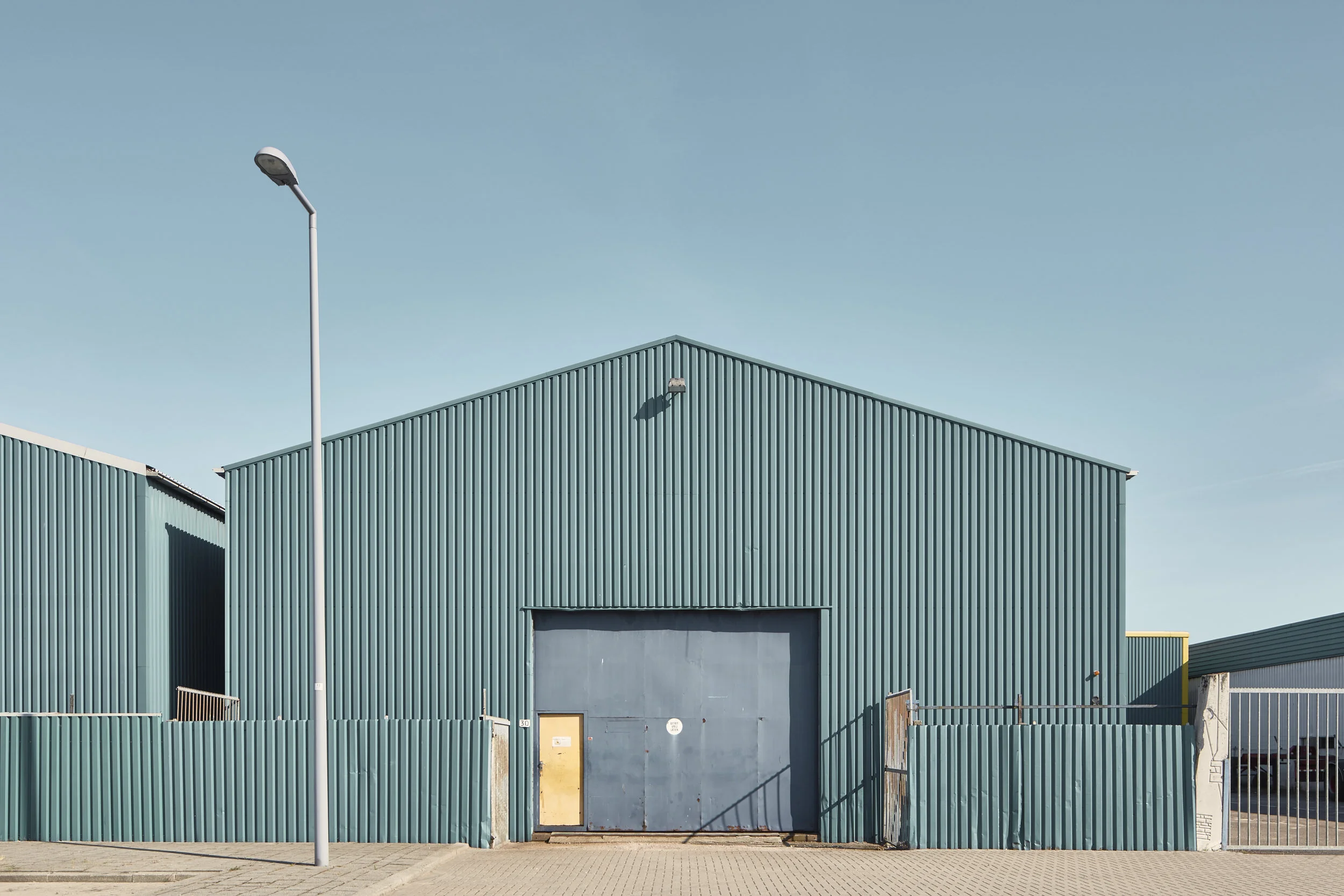
In questa regione percorriamo i confini amministrativi della città. Una sequenza di paesaggi industriali, infrastrutture e servizi. La città si riunisce in aree monofunzionali dominate da aree per la logistica, trasporti, infrastrutture ed espansioni residenziali. Questa storia si colloca lungo l'autostrada A15 a sud, lungo la A16 lungo il confine orientale e i territori settentrionali in direzione di Delft, Zoetemeer e Gouda
In Rotterdam, we walk the administrative limits of the city. A sequence of industrial landscape, infrastructure and services. The city comes together in monofunctional areas dominated by infrastructure services and residential expansions. This story places itself along the motorway A15 in the south, along the A16 along the eastern border and the northerly territories heading towards Delft, Zoetemeer and Gouda.
Turin
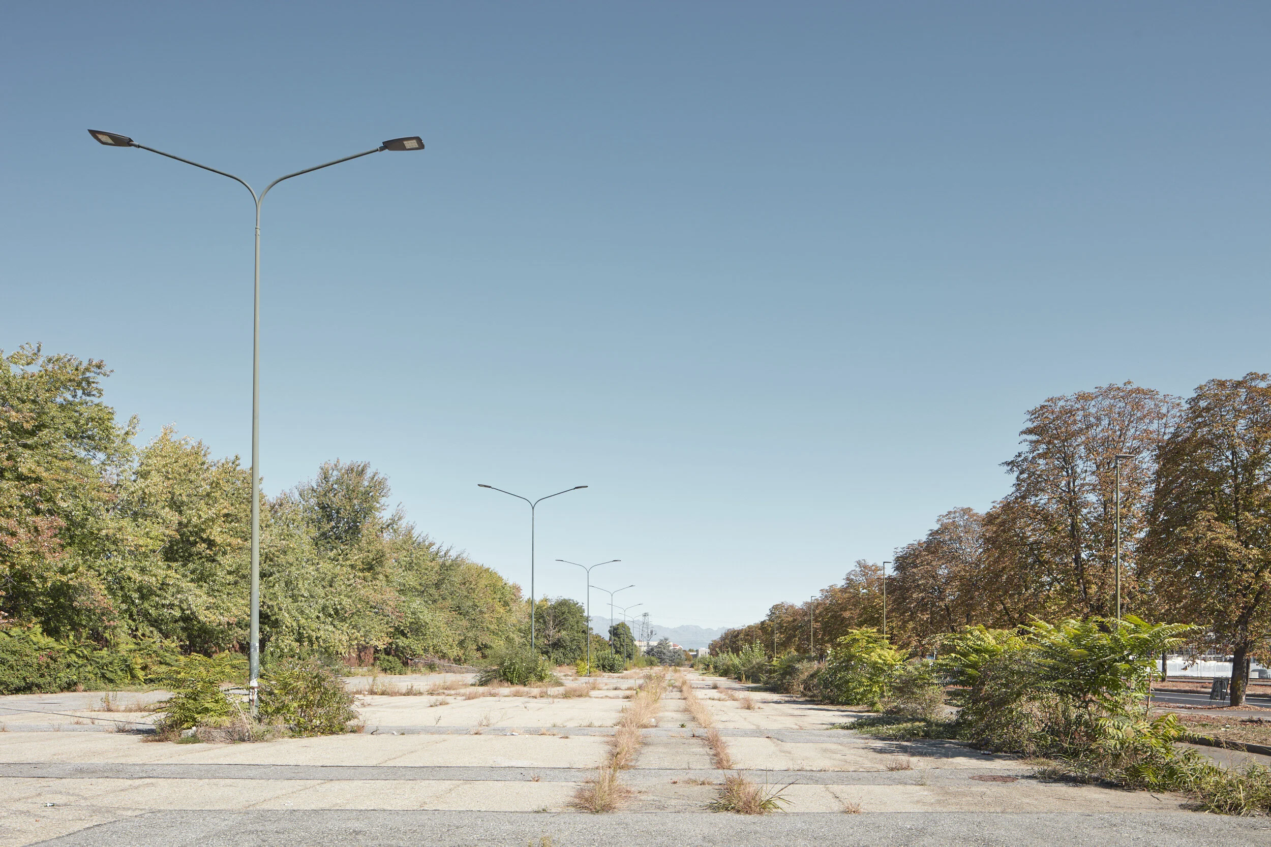
A Torino, il progetto fotografico coglie la transizione urbana. Terrains vagues, solitudine, silenzio, sono i temi dominanti ai confini della città che si sono consolidati in una sovrapporsi di elementi e dove il patrimonio industriale dismesso è la caratteristica principale.
In Turin, the documentary catches the urban transition. Terrain vague, loneliness are the dominating themes on city borders which are consolidated and where the industrial heritage is the main feature.
Città dopo città, il progetto “Report from the edge of the city” costruisce una narrazione su queste realtà ai margini.
Il progetto registra la dimensione spaziale e sociale dei limiti amministrativi e le loro caratteristiche oggi. Come far fronte all'accelerazione delle dinamiche urbane e dominare la crescente estensione della scala territoriale e l'aumento della complessità dei sistemi di governance e di pianificazione ? Questa ricerca fotografica offre materiale di confronto dei confini comunali a livello europeo, fornendo elementi di studio di quei territori. Utile per un'analisi approfondita delle problematiche e delle sfide progettuali in queste aree di transizione, essa stimola una riflessione sul lungo periodo.
La domanda a cui questa ricerca cerca di rispondere riguarda non solo i Paesi Bassi, l'Italia o la Spagna, ma si estende in tutta l’Europa e oltre.
City after city, the project ‘Report from the edge of the city” builds up a narrative about these realities at the margins.
The project registers the spatial and social dimension of the administrative limits and their features today. How can we cope with the acceleration of the urban dynamics and master territorial widening and increasing governance and planning complexity? This photographic research offers material for comparison of the city boundaries at the European level, providing the elements for the observation of these territories. Useful for an in-depths analysis of the planning issues and challenges in those transitional areas, it stimulates a forward-looking reflection.
The question to which this research is trying to answer concerns not only the Netherlands or Italy or Spain but extends across Europe and beyond.


